Information about cookies
This website uses cookies to provide services at the highest level. By continuing to use the site, you agree to their use.

Level 4 automation
is closer than you think

Perception enabling technology

Broad application of sensors

Broad application of sensors

The vehicle will be equipped with 7 lidars, 11 video cameras,
4 radars, 3 GNSS receivers and an IMU. The sensors will
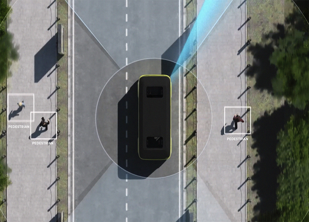
cover the entire area around the vehicle and provide an enhanced orientation in the area and the current traffic conditions. Since they will operate at different ranges, the minibus will be responsive in varying light and weather conditions. Additionally, the ranges of sensors overlap, which increases security if any of them gets damaged.

Technology behind

GNSS
GNSS navigation satellite system receivers combined with precision-enhancing RTK technology allow to accurately determine a vehicle’s position and orientation in the global coordinate system. They use, among other things, the most popular GPS system.
IMU
Inertial measurement units are used to measure the forces acting on the vehicle. They enable to navigate the vehicle in a situation if the GPS signal is temporarily lost or if lidars provide an inaccurate location.
Odometry
Using data on the relative displacement of the vehicle obtained
from the wheel rotation sensor, the system can optimise the vehicle positioning method.
Odometry is independent of environmental conditions and serves as a good source of information
on changes to vehicle position when measurements from more accurate sensors are not available.
Radars
Like lidars, they can detect obstacles and measure their speed accurately. Although radars are less accurate compared to lidars, they enable driving in severe weather conditions, during heavy rainfall for instance.
Video Cameras
They enable to monitor the surrounding of the vehicle. If necessary, they allow the remote driver to manoeuvre. Machine learning techniques, in turn, enable to detect and categorise obstacles around the vehicle.
Lidars
They make it possible to build a spatial map of the vehicle surroundings so that the vehicle can determine its location, build its perception and detect obstacles, including their shape and distance from them.

Highly accurate lidars

The vehicle will be provided with a range of high-resolution solid-state lidars. These innovative sensors have no mechanical parts, which makes them more reliable and ensures better data quality compared to conventional rotating lidars.

Positioning system

An advanced centimetre-accurate positioning system is a key prerequisite for autonomous driving. It combines data from multiple sources such as RTK GPS, lidar registration, visual odometry and wheel odometry. This makes the system resilient to the failure of a single data source.

Perception algorithms

The perception algorithms built into our vehicle are tailored to the environment in which it operates. They can be an excellent example of maintaining balance between cutting-edge technologies such as deep learning and conventional approaches based on analytical methodologies.

All vehicle manoeuvres are monitored by an independent safety surveillance module, aimed at ensuring safety of the vehicle en route.

High-definition maps

We prepare high-definition maps for every autonomous vehicle route. They ensure initial terrain information, which is further extended by data from vehicle sensors. The maps are also enriched with additional information such as bus stop locations or any areas where the vehicle should slow down to make passengers feel safer.

Smooth ride

The self-driving system of BB-1 continuously adjusts driving parameters such as speed, acceleration, deceleration and centrifugal force to make passengers feel comfortable.

Moreover, the system will be able to compensate for minor vehicle problems, such as low tyre pressure. All this is done without compromising the safety of users and everyone around.

Object tracking

Object tracking enables to apply environmental constraints on the object recognition layer. These barriers can include, among others, physical obstacles to the movement of an object. The function therefore works as a kind of filter that is applied to the results of object detection or classification.

Object tracking also enables to predict the behaviour of other road users in order to respond accordingly to potentially dangerous situations.
Let’s jump to safety